More than 30,000 properties were without power across Scotland on Sunday as Storm Boelo brought damaging winds, flooding and widespread travel disruption.
Scottish and Southern Electricity Networks said just over 24,000 customers across the north of Scotland were still waiting to be reconnected at 11am, with Argyll, Skye and the Western Isles among the areas worst affected.
Engineers had already restored supplies to more than 19,500 customers since the storm arrived. SSEN said gusts in excess of 80mph had swept across Argyll.
A further 6,000 properties across central and southern Scotland were without electricity on the SP Energy Networks system on Sunday morning, with Ayrshire and Dumfries and Galloway particularly affected.
Repair teams have been deployed across both networks, although continuing severe weather has made reaching and repairing some faults difficult.
Storm Boelo produced some of the strongest winds of the autumn so far, with the Met Office recording gusts of 84mph at Machrihanish in Argyll and Bute and 82mph on Tiree. Gusts reached around 62mph in the Glasgow area.
The winds combined with heavy rain and high tides to cause flooding in parts of the west coast.
Largs was among the worst affected places, with streets and businesses inundated overnight. Flooding was also reported in Dumbarton and Rothesay, while Shore Road at Skelmorlie was closed after seawater affected the coastline and damaged the road.
Fallen trees and debris have also caused problems across the road network, with closures reported on routes including the A75, A82, A83 and A1 during Sunday.
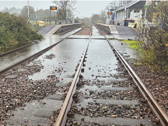
Rail services have been heavily disrupted, with speed restrictions across Scotland and a number of lines closed until Network Rail engineers can inspect them for storm damage and debris.
An amber warning for wind remains in force across much of Scotland until 9pm on Sunday.
The worst of Storm Boelo is expected to gradually ease from the west during the afternoon and evening.
Across Glasgow and western Scotland, winds will steadily decrease through Sunday evening, with scattered showers becoming less frequent overnight. Northern Scotland will remain exposed to stronger winds and showers for longer, with severe gales possible in some areas initially before conditions ease overnight.
Flooding remains a concern even after the strongest winds subside.
SEPA said coastal flooding remains possible across western and northern Scotland on Sunday, while continued rainfall could cause river and surface-water flooding in northern areas.
And there will be little respite before another Atlantic weather system reaches Scotland.
Monday is expected to begin relatively dry and bright in many areas before another band of rain pushes northwards during the day.
Conditions will become increasingly windy during Monday afternoon and evening, with SEPA warning that another period of coastal flooding could begin in south-west Scotland on Monday evening before spreading around much of the Scottish coastline through Tuesday.
The Met Office has already issued a yellow warning for wind covering much of Scotland from 3am until 11.59pm on Tuesday.
West to south-westerly winds could produce gusts of 50 to 60mph quite widely, while exposed coastal areas could see gusts of 70mph or more.
The strongest winds are expected to ease from the south-west later on Tuesday, although northern Scotland could remain windy for longer.
Conditions should become less severe from Wednesday. The current forecast points to bright spells mixed with scattered showers on Wednesday, with winds easing, followed by a largely drier Thursday with variable cloud and some sunshine.
The Met Office’s broader outlook suggests higher pressure could then begin to exert more influence towards the end of the week, bringing the possibility of a more settled period after several days of repeated Atlantic storms.