Flood barriers installed at a cost of £10 million were not activated during Storm Boelo because forecasts predicted the River Clyde would remain well below dangerous levels.
A new report has revealed that the river reached its highest recorded level since 1998, almost twice the predicted height, as floodwater swept through parts of Renfrew on Saturday 24 October.
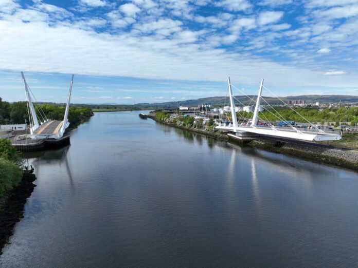
Thirteen businesses suffered flooding, while extensive damage to the nearby Renfrew Bridge has left the £117 million crossing closed for several months.
Renfrewshire Council has now launched a comprehensive review into why forecasts were so inaccurate and whether its procedures for activating flood defences need to change.
The findings will be considered by councillors at a meeting of the Infrastructure, Land and Environment Policy Board today (Wednesday 4 November).
The report reveals that the highest tidal forecasts for Renfrew were between 2.2 metres and 2.42 metres.
Under the council’s established procedures, staff would be sent to monitor the flood barriers when forecast levels reached 3.6 metres. A predicted level of 3.9 metres would trigger their activation.
The actual evening tide reached 4.49 metres – the highest level recorded at that location since digital records began in 1998.
Despite the severe weather, the Scottish Environment Protection Agency (SEPA) had issued no flood warning for Renfrew ahead of the storm.
The council said its procedures had been followed correctly based on the information available at the time.
The £10 million North Renfrew Flood Prevention Scheme was completed in 2016 to protect homes, businesses and infrastructure.
It includes a kilometre-long embankment, two flood barriers at Ferry Road and Fishers Road, and a pumping station at Mill Burn on Fingal Road.
The pumping station was operating during the storm, but the barriers remained down.
According to the council, there have been 45 amber or red weather warnings affecting the wider Strathclyde area since 2016, without tidal forecasts reaching the threshold for activating the barriers.
The report also reveals that eight of the 13 businesses affected were located on the river side of the defences at Ferry Road.
These premises would have been flooded even if the barriers had been activated, the council said.
Ten of the affected businesses are understood to have reopened, with council staff providing support and helping to remove damaged materials.
The flooding also caused extensive damage to the southern operating plant room of Renfrew Bridge, which opened in May 2025.
Water entered the room containing electrical equipment controlling the bridge’s hydraulic systems, leaving the structure unable to operate normally.
The council said the bridge damage was unrelated to the decision not to raise the flood barriers.
The crossing remains within its two-year defects period, and the contractor and council insurers are investigating whether a defect contributed to the water entering the plant room.
Renfrew Bridge is expected to remain closed to road users for months while repairs and investigations continue.
The council will work with SEPA and other agencies to establish why the forecast was so far below the actual tidal level.
Gordon McNeil, Renfrewshire Council’s director of environment, housing and infrastructure, said the authority needed to establish what went wrong with the forecasting.
He said: “It is important we work with our partners to understand why the forecasting was significantly different from what we subsequently experienced.”