An ordinary farmhouse outside St Andrews hides a tunnel descending towards a command centre built 100ft beneath the Fife countryside.
In Edinburgh, another labyrinth lies buried beneath Corstorphine Hill. In East Kilbride, an anonymous concrete building was constructed to help coordinate the aftermath of an atomic attack.
Elsewhere, tiny underground rooms were hidden in fields where teams of three people would have waited for nuclear bombs to fall, measuring the blasts and tracking the radioactive fallout spreading across Scotland.
These places are remnants of a largely hidden network that once stretched across the country.
For more than four decades, Scotland occupied an unusually important position in the Cold War confrontation between the West and the Soviet Union.
Its location between North America and the USSR, together with direct access to the Atlantic, made it strategically important to NATO. Radar stations watched the skies, listening posts intercepted signals, airfields prepared for nuclear bombers and American ballistic missile submarines operated from Scottish waters.
At the same time, governments quietly prepared for the possibility that Scottish cities might be destroyed.
More than 300 Royal Observer Corps monitoring posts were built across Scotland, while a network of much larger bunkers was prepared for politicians, officials, broadcasters and military commanders who would attempt to maintain some form of government after nuclear attack.
Some have disappeared. Others remain hidden behind fences, beneath hills or among ordinary buildings.
A handful can still be visited.
Together they tell the story of a Scotland that spent much of the second half of the 20th century preparing for a war everyone hoped would never happen.
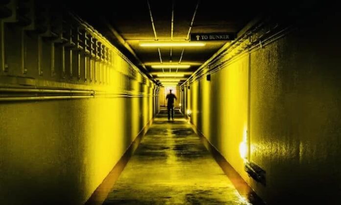
Scotland’s Secret Bunker, Fife
Perhaps the most extraordinary surviving example lies beneath a seemingly ordinary farmhouse in the countryside near St Andrews.
RAF Troywood was built in the early 1950s as part of Britain’s ROTOR radar system, created as the threat from the Soviet Union transformed Britain’s post-war defences.
The R3 bunker extends around 100ft underground and contains about 24,000 sq ft of accommodation across its operational levels.
Its original purpose was to help detect and track hostile aircraft approaching Britain. As technology changed, so did Troywood.
It later became part of the country’s emergency government system, providing a protected location from which military commanders, civil servants and other officials could operate after a nuclear attack.
Inside were plotting rooms, communications equipment, dormitories, an operations room and broadcasting facilities.
The facility remained secret for decades and stayed operational until the early 1990s. It is now the Scotland’s Secret Bunker visitor attraction, making it one of the few places where the infrastructure of Cold War Scotland can be experienced largely from the inside.
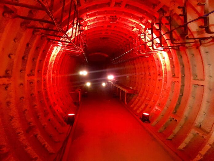
Barnton Quarry, Edinburgh
Deep beneath the western edge of Edinburgh lies another command centre with an even more remarkable history.
The military complex at Barnton Quarry contains structures from both the Second World War and the Cold War.
Between 1951 and 1953, a vast R4 ROTOR Sector Operations Centre was constructed inside a former quarry on the north side of Corstorphine Hill.
It formed part of the radar network intended to detect Soviet aircraft approaching Britain.
Radar technology rapidly advanced and the original system was effectively obsolete within only a few years. Barnton was subsequently transferred to the Scottish Office and given a very different role.
It became the Scottish Central Emergency Government Headquarters.
If nuclear war had destroyed normal government communications, a regional commissioner and officials would have attempted to maintain command from inside the bunker.
A BBC studio was installed so information could continue to be broadcast to survivors.
The complex remained part of Britain’s emergency planning until the early 1980s before falling into dereliction. A restoration project has since sought to preserve the extraordinary underground site.
Historic Environment Scotland describes Barnton as an extremely rare survivor whose history reflects the “secrecy, subterfuge and fear” that defined the Cold War.
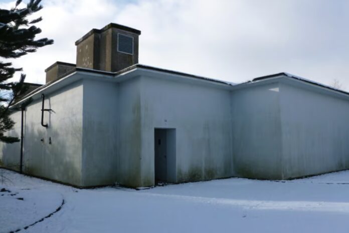
East Kilbride Regional War Room
East Kilbride has two striking relics of Scotland’s preparations for nuclear war. The first, beside the former National Engineering Laboratory at Birniehill, was built in the early 1950s as the Western Zone Regional War Room.
Unlike many Cold War bunkers, it stands above ground, protected by walls and a roof around 1.5 metres thick. From here, officials would have coordinated civil defence across western Scotland after an attack.
By around 1960, the building was considered inadequate against the growing threat from hydrogen bombs and the command centre moved to a second site at Torrance House, now within Calderglen Country Park.
That bunker had originally been built as an Anti-Aircraft Operations Room and later became the Western Zone headquarters, with space for police, fire, military and health officials as well as a BBC studio.
The original Birniehill bunker later became the Glasgow Group Control and then Strathclyde County Control, remaining in use until 1996.
Both buildings still survive, giving East Kilbride a glimpse of how Britain’s Cold War emergency planning evolved.
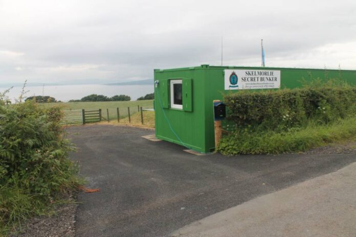
Skelmorlie Secret Bunker, North Ayrshire
The people inside East Kilbride headquarters needed information about what was happening outside. That was where the Royal Observer Corps came in.
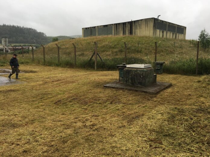
Across Scotland, hundreds of tiny monitoring posts were constructed, usually buried beneath fields with little more than a hatch and ventilation shafts visible above ground.
Skelmorlie’s post was built in 1965.
It was designed for just three people. In the event of nuclear war, ROC volunteers would have descended inside and used specialist equipment to determine where nuclear weapons had exploded, estimate their power and measure radioactive fallout.
The information would then have been passed up the chain to help authorities plot the areas being contaminated.
The Skelmorlie post remained operational until the nationwide stand-down in September 1991.
It was restored in 2004 and today provides one of the clearest illustrations of what would have been expected of the ordinary volunteers stationed beneath the Scottish countryside during an attack.
Cultybraggan, Perthshire
One of Britain’s last Cold War bunkers was completed just as the risk of conflict it was designed for was disappearing. A new Regional Government Headquarters was constructed at Cultybraggan Camp near Comrie during the final years of the Cold War.
The two-storey protected complex was completed in 1990 at a reported cost of around £3.6 million. It was designed to accommodate as many as 150 people.
In the event of nuclear war, the Secretary of State for Scotland, government officials, the BBC, British Telecom and other organisations could have operated from the facility.
The Berlin Wall had fallen in November 1989. The Soviet Union would cease to exist in December 1991.
One of Scotland’s most sophisticated pieces of Cold War infrastructure was therefore effectively overtaken by history almost as it was being completed.
Holy Loch, Argyll
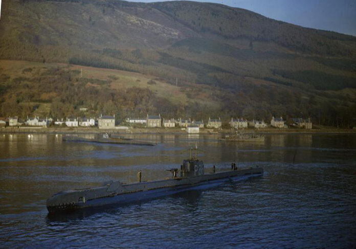
Not all of Scotland’s Cold War story was hidden underground. On 3 March 1961, the submarine tender USS Proteus arrived in Holy Loch and established one of the most visible symbols of the nuclear stand-off in western Europe.
The US Navy used the sheltered waters beside Dunoon to support its ballistic missile submarines. The submarines carried Polaris nuclear missiles and would leave the Clyde on deterrent patrols during some of the most dangerous periods of the Cold War.
The American presence transformed Dunoon. Thousands of US servicemen and their families became associated with the area, bringing a striking piece of American culture to the Cowal peninsula while anti-nuclear campaigners protested against the presence of the weapons.
Holy Loch remained a US submarine support base for more than three decades. The last American ships departed in 1992, leaving one of Scotland’s most unusual Cold War communities behind.
RAF Edzell, Angus
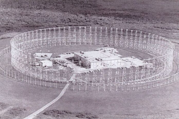
For decades, an extraordinary circular structure dominated an American intelligence station in Angus.
RAF Edzell became home to a US Navy high-frequency direction-finding station during the Cold War.
At its centre was a vast Wullenweber antenna array nicknamed the “elephant cage”.
Rather than watching aircraft, the installation listened.
The array could identify the direction from which radio transmissions were coming and was used to detect and monitor signals originating across the North Atlantic and Eastern Europe.
It was part of an intelligence network that turned remote parts of Scotland into listening posts in the confrontation with the Soviet bloc.
National Museums Scotland describes the US-controlled station at Edzell as one of the physical legacies of the Cold War that became woven into the surrounding community.
Inverbervie Radar Station, Aberdeenshire
A few miles along the east coast was another installation largely hidden from public view.
The Inverbervie radar station at Bervie Brow was constructed in the early 1950s as part of Britain’s warning system.
A bunker of around 10,000 sq ft was built underground, with the entrance disguised behind a more conventional-looking surface building.
The station became operational in 1953.
It was later taken over by the US Navy and modified for intelligence and communications work connected with the American presence at Edzell.
The bunker survived after the military left and eventually passed into private ownership.
It is a reminder that some of Scotland’s most significant Cold War structures now sit in the landscape with almost nothing to reveal the role they once played.
Mormond Hill, Aberdeenshire
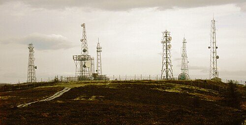
On another Aberdeenshire hill, the UK government was building a communications link that could send warning of nuclear missiles across the Atlantic.
Mormond Hill formed part of the system connecting the Ballistic Missile Early Warning network with commanders in North America.
Huge microwave antennae received and transmitted signals using a technique known as tropospheric scatter, allowing radio signals to travel beyond the normal horizon.
Information from the missile warning station at RAF Fylingdales in Yorkshire could therefore be relayed onwards towards the United States.
The enormous antenna structures have gone, but aerial photography preserves the scale of an installation that once linked rural Aberdeenshire directly into the machinery of nuclear deterrence.
RAF Saxa Vord, Shetland
Few places illustrate Scotland’s geographical importance better than Saxa Vord on Unst.
Sitting at the northern edge of Britain, the radar station became fully operational in October 1957.
Its task was to watch the northern approaches at a time when Soviet aircraft represented one of the most serious threats facing Britain and NATO.
The distinctive radar installations became part of the landscape of Unst, while the station remained a significant part of Britain’s air-defence network throughout the Cold War.
Saxa Vord eventually closed as a permanently manned RAF station, although changing security conditions led to radar operations returning to the site decades later.
Its position explains why Shetland – seemingly remote from the centres of political power – was actually sitting on one of the front lines of the Cold War.
Tomnaverie, Aberdeenshire
Perhaps nowhere is the passage of Scottish history more striking than at Tomnaverie.
The recumbent stone circle near Tarland was used around 4,500 years ago. Beside it sits an underground Royal Observer Corps post was constructed there in 1960 and remained operational until 1991.
If nuclear weapons had struck Britain, the volunteers inside would have monitored the explosions and the fallout that followed.
Today the surface structures of the bunker remain beside the prehistoric monument.
One was created by people who watched the landscape and skies thousands of years ago. The other belonged to a generation watching the same horizon for signs of nuclear war.
Across Scotland, hundreds more remnants survive. There were more than 300 Royal Observer Corps posts alone, as well as V-bomber dispersal airfields, radar stations, naval installations, communications sites and emergency government centres.
Some have been demolished. Others have been converted, sealed or swallowed by vegetation. Many are easy to pass without ever knowing why they were built.
For decades they formed a largely invisible architecture of survival – created for the moment when the Cold War might suddenly become a real one.